Thursday, September 2, 2010

We're Grandparents!


Welcome to the world, Diego Aaron Escobosa!

Miranda is a happy Mom.

Aaron is a proud Dad.

Aaron placing Diego in the "incubator crib."

Diego Aaron Escobosa.  Born at 10:06am on 9-2-10.  6 pounds, 6 ounces. 19" long.

One very happy Grandma (Cathy) with one very tiny Diego.

Grandpa (Michael) and Diego.

Great Grandma (Tomya Lewis -- Michael's Mom) and Diego.

Uncle Adam holds Diego.

Jillian holds Diego.  Adam looks on.
The next generation:  Aaron's sister, Maggie, holds Claire (age 9-1/2 months) while Aaron holds Diego.


Friday, April 30, 2010

Arkansas Ozarks Vacation -- Day 9

Who was the Guest of the Day at our hotel in Hot Springs?  We were, of course.
Yellow, blue, and pink houses all in a row, near downtown Hot Springs, Arkansas.
Here I am outside the Gangster Museum of America in downtown Hot Springs.  It was well done and our private tour guide was informative and entertaining.
Look!  I've captured Al Capone, using one of his own tommy guns.  This is at the end of the tour in the Gangster Museum of America.
Flags on the wall in the Colonial Restaurant, next door to the Gangster Museum of America, in Hot Springs, Arkansas. The Arkansas state flag has four big stars near the middle, one for each of the four nations that have controlled Arkansas territory:  The United States, France, Spain, and...  and... Wait a minute, they claim the Confederate States of America was an actual nation.  Hmmm, not legally, I don't think.
Here is the Hot Springs Mountain Tower.  We went up to the observation deck even though the clouds were so thick that often you couldn't see the ground from the top of the tower and vice versa.

[There are no photos of the couple's mineral bath with aromatherapy, massage, and foot reconditioning treatment we enjoyed at the Quapaw Baths on Friday afternoon.]

Al Capone's 1928 Cadillac, on display in the lobby of the Arlington Hotel.  This was the last day it was on display; it was being sent back to its owner tomorrow. Chicago had black and green Cadillacs for their police cruisers, so Capone had his painted the same color to make it harder to identify.
After having dinner at the Porterhouse Steakhouse...
...we headed for home.  My plan was to drive to somewhere in southern Illinois, spend the night, then drive the rest of the way home.  But Mother Nature had another idea.  We left Hot Springs about 6:30pm, and it was raining heavily and storming by the time we got to Little Rock.  As we neared the airport, the rain was really coming down and Cathy pointed out a very black cloud immediately to our southwest.  We turned on the radio and got out the map and discovered there were several tornadoes in the area.  We hit I-40, heading for Memphis, and drove at high speed to attempt to outrun them.  But new tornadoes appeared to be forming as we went.  We finally decided it was too dark to see if we were in danger or not and it was better to be in a  building as opposed to on the road.  We pulled off in Brinkley, Arkansas, about half way between Little Rock and Memphis, and got a motel room.  For the next three hours we watched the Little Rock TV stations that were reporting one tornado warning after another.  At some point we said we had to go to sleep and if we "woke up dead" we wouldn't be able to do anything about it.  I took a snapshot of the following weather alert map.  Each little red blotch represents a county with an active tornado warning at that moment.  I blew up the map and counted them.  There were 18 of them --- 18 simultaneous tornado warnings in eastern Arkansas, right where we were. (This storm system, as it moved through Tennssee, wuld produce the devasting flash floods that killed about 30 people.)

Thursday, April 29, 2010

Arkansas Ozarks Vacation -- Day 8


The main lobby in the Mather Lodge in Petit Jean State Park, near Dardenelle, Arkansas.
The most spectacular vistas of our trip were at Stout's Point in Petit Jean State Park.  First here's a close-up of Petit Jean's gravesite, surrounded by wrought iron fencing...

...but here you can see that the grave is actually on the precipice of Stout's Point.

From Stout's Point there are fantastic vistas of the Arkansas River valley.
Here I am at Stout's Point, the camera is looking more or less due east...

...but looking just a bit farther south, the view looks like this:

My favorite shot. Stout's Point boulders in the foreground, with a winding road and the yellow wildflowers in the valley meadows below.

Just to prove that they actually encourage people to go out on the boulders to get a better (but much more dangerous) view of the valley, here you can see a clearly intentional opening in the railing, with steps leading down and out to the boulders!
From Petit Jean State Park we took Arkansas State Route 7 south about 2 hours until we reached Hot Springs, which unfortunately boasts...


We had lunch at McClard's Bar-B-Q, an old-fashioned, Mom-and-Pop, hole-in-the-wall joint. It's said to be Bill Clinton's favorite Bar-B-Q restaurant, and they claim he still comes by to eat here whenever he comes to town.  There are plenty of Clinton photos all over the wall, including one of what one would suspect to be 3rd-generation McClard's with him in the Oval Office.


Then it's on to Hot Springs National Park. It's a strange sort of National Park, with historic Bathhouse Row on the east side of Central Avenue (and technically in the park) but with shops, art galleries, restaurants, and the like on the west side of the street. Here is a snapshot of one of three public fountains that dispense the mineral water.  Seems somehow weird to watch people pull up to the curb, haul out three or four jugs, fill them up with water, and drive off.  Is the water truly hot?  You bet it is!


There are eight historic Bath Houses along Bathhouse Row.  They were built between about 1890 and 1910.  They are close to the sidewalk, and a strip of fairly tall trees stands between the sidewalk and busy Central Avenue.  As a result, even though the Houses sit fairly close to each other, it is impossible to get a photo that gives an accurate sense of the breadth of the Row.  Each House is architecturally unique from the others.  Only two of them are still in operation, the Buckstaff and the Quapaw (both of which are operated by a permit from the National Park Service), a third (the Fordyce) is the National Bath House Museum (some photos from that a bit later), and thus the other five are empty, many of them closing as recently as the 1980's. They exude a beautiful yet eerie quality, even in broad daylight.  Here is a shot of the Ozark Bath House, with its red Spanish tile roof, twin towers, small white awnings, and carved flowerboxes. It's empty.
Here is a corner view of the Quapaw Bath House.  It is the largest on the Row, and the one in which we will have our bath and massage tomorrow afternoon. 
The Quapaw is highlighted by its large gold dome with blue tile insets, fish-in-sea-shell motif, and a large twin collonaded verandas on either side of the tri-awning entrance.
Hot Springs has a very checkered past. It was a hotbed (pardon the pun) of ganster activity, and illegal casinos (up to 130 of them!) operated well into the 1960's. Here's a shot of Maxine's, on Central Avenue, a notorious brothel in the 1950's and 60's; it's now a bar bearing her name.

The Arlington Hotel. Strategically located an the north end of Bathhouse Row on a curve on Central Avenue, Al Capone maintained a suite (room 443) year-round here, and when he came to town he would rent out the entire 4th floor.  He could look out his front window and see who was coming and going into his various speakeaies and casinos, most notably the Southern Club just one block away, which today is Madame Trussard's Wax Museum.
We toured the Bathhouse Musem in the Fordyce, which attempts to maintain the Baths as they were in their heydey about a century ago.  Here is a shot of one of the private shower stalls.  This is the height of plumbing technology in 1905.

Steam cabinets.  Or torture devices.  We weren't sure.
The things with hoses were called needle sprayers.  And recall the water was HOT .... Yikes!
In the ladies' side of the Bath House, in the massage area, there was this heat lamp apparatus, a precursor to today's tanning beds - if it didn't electrocute you, I guess.
There were rows and rows of these tiny changing stalls in the Women's Dressing Room.  The Bathhouses were very popular among both the rich and the common folk way back then, and were nearly always full.
A great view from the veranda of the Fordyce bath House, looking out to the shops on the other side of Central Avenue.
Cathy and I had a great meal at Belle Arti Italiano Ristorante in downtown Hot Springs.

Wednesday, April 28, 2010

Arkansas Ozarks Vacation -- Day 7

Morning view from our balcony at the Lodge at Mount Magazine State Park, near Paris, Arkansas.  You can see our balcony, then the walkway along the top of the bluff, then the trees along the bluff (right after that, unseen from this angle, is a sheer cliff drop of about a thousand feet), then the river valley below with farms and woodlands, then the Petit Jean river in the valley (the right half is shrouded in fog), then the mountains on the other side of the valley.  The photos don't really do it justice....


A view from inside our room, showing the beautiful scenery right off our balcony.


A view of the main lobby sitting area.  Last night we were the only ones there.  They told us to make ourselves at home, so we did -- we fell asleep while trying to read. Too much fresh air, I guess.
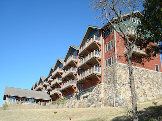
The Lodge at Mount Magazine.  They built it right -- all rooms overlook the river valley (none overlook the parking lot on the other side). Our roon was the second balcony in from this end on the top floor.

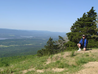
Here I am on what looks like a grassy knob overlooking the Petit Jean river valley.  That's true enough, but if you really look close, just behind the pine tree above my right shoulder, you will see a little piece of something red on a skinny pole.  That's a wind sock, and I'm squatting on the hang-glider "launch pad" in the Park. What looks like a fairly gentle slope downward in the left part of this photo is actually a near sheer dropoff several hundred (maybe a thousand?) feet down to the river valley.  I can't imagine anyone intentionally jumping off this perch, whether or not attached to a hang glider.  A sign nearby says "Hang gliders must register at the Visitor Center" -- I think that's so they can notify the next of kin.
 Here's an unnecesary sign.  It's at one of the many scenic overlooks along the roads in Mount Magazine State Park.
Here's Cathy, halfway along the right side of the photo, trying to decide what to order for lunch at Stoby's, a restaurant built inside an old railroad car, in downtown Russellville, Arkansas.
A statue in Dardenelle, Arkansas.  The enscription reads: "To the Confederate soldiers of Yell County, in appeciation of their splendid valor alnd loyalty, this monument is erected."  It's not acceptable anymore (if it ever really was) to display the traditional "Stars and Bars" Confederate flag. So we often saw the version flying here, which has the correct number of stars (eleven) representing the good ol' Confederate States of America.  Really, who do they think they're fooling?  It's still a Confederate flag, just revamped for the illusion of political correctness.
A very old and famous tree, the Council Oak, on the southern shore of the Arkansas River, in Dardenelle, Arkansas.  A plaque reads: "Upon this spot, under the Council Oak, acting Governor Robert Crittenden, and Chief Black Fox, tribe spokesman, met in council, April 1820, and made the treaty which gave to Arkansas all the Cherokee land south of the Arkansas River."  I hope I look that good and strong when I am at least 190 years old.
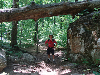
Along the Cedar Falls Trail in Petit Jean State Park, near Dardenelle, Arkansas.
After an hour of fairly strenuous hiking, including hundreds of steps carved out of the canyon wall by the CCC back in the Great Depression, we arrive at the spectacular Cedar Falls, 95 feet high, as seen from the floor of the canyon formed by Cedar Creek.
After hiking back out of the canyon, we had dinner at he Mather Lodge in Petit Jean State Park.  Here is a view from the dining room. Barely visible in the haze on the horizon is Mount Magazine, where we spent last night.

Here is the Cedar Falls Overlook.  This will give us a different perspective of the falls than that seen two photos ago. Here we will see the falls from above and on the opposite side of the canyon.
Walking out to the far railing on the Overlook shown in the photo above, we took this photo looking down (waaaaay down!) to the Falls below.  This gives you a real appreciation for how far down in the canyon we were when we took the earlier photo!
It's worth another view...
Two overlooks of Cedar Falls, each on opposite sides of the canyon.  The one in the foreground, the "CCC Overlook," is probably closed.  We say "probably" because the next day, when we asked the Park Ranger about it, he claimed to not know it existed (and although it's marked on the map, it is no longer marked on the trail, and it's not easy to find).  It looked too flimsy to stand on, so we didn't dare.  The other overlook, between the trees in the center top of the photo, is the one from which we took the photos shown above.
I took this photo from the back of Rock House Cave, looking out.  (Cathy is looking in, taking a photo of me.)  By this time it was beginning to get dark and Cathy was too scared to enter the cave.
The sun sets behind Mount Magazine far off on the horizon.